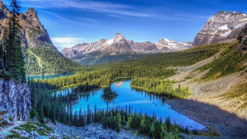
Ever wondered why oceanic fossils exist at the peaks of the Rocky Mountains? It sounds impossible, the idea that shells, coral, and ancient marine life now sit thousands of feet above sea level, scattered among granite ridges and alpine tundra. But those fossils aren’t misplaced; they’re storytellers. They whisper of a time when the heart of North America wasn’t mountainous at all, but submerged beneath a vast, shallow sea.
To understand how the Rockies came to be, you have to start long before they rose, when the continent itself was still finding its shape.
The Ancient Foundation: Laurentia’s Birth
Long before the first peaks pierced the sky, there was Laurentia, the ancient continental core that would become North America. More than two billion years ago, Earth’s early crustal fragments, old, battered blocks of granite collided and welded together through a series of orogenies (mountain-building events). These collisions stitched smaller landmasses into a single continental nucleus.
By the Proterozoic Eon, Laurentia was solid, stable, and massive, a craton with roots deep in the mantle. Over eons, island arcs and microcontinents accreted to its edges like patches on a well-worn quilt, expanding the landmass westward. Each collision left behind scars, sutures, faults, and weak zones, buried deep in the crust. Those ancient wounds would later guide the tectonic forces that built the Rockies.
The Calm Before the Mountains: An Ocean Splits a Continent
Fast forward to the Late Cretaceous, about 100 million years ago. Instead of mountains, the center of North America was an inland sea. The Western Interior Seaway stretched from the Gulf of Mexico to the Arctic Ocean, a warm, shallow body of water that split the continent in two.
The sea formed because the weight of mountains rising in the west, from the Sevier Orogeny, caused the crust farther east to bend downward, creating a massive trough. Rising global sea levels filled that depression, transforming what’s now Kansas, Nebraska, and Wyoming into a tropical seafloor.
Sharks, ammonites, and giant marine reptiles like mosasaurs swam over what would one day be Denver. Thick layers of mud and plankton settled to the bottom, slowly compacting into shale and limestone, rocks that would later be uplifted and exposed high in the Rockies.
For tens of millions of years, this sea thrived. Its edges shifted with sea-level changes, its depths recorded in alternating layers of chalk, sandstone, and shale. Then, slowly but relentlessly, tectonic forces began to turn the sea into sky.
The Mystery of Mountain Birth: Competing Theories of the Rockies’ Rise
When it comes to how the Rockies rose, geologists don’t agree on a single story. Instead, it’s a geologic mystery, several suspects, a few missing clues, and plenty of fingerprints left behind in the rocks. The peaks we see today are the result of immense crustal forces, but how those forces reached this far inland remains one of North America’s great tectonic puzzles.
Theory 1: The Flat-Slab Subduction Model
One of the leading ideas points to the Farallon Plate, an oceanic plate once sliding beneath western North America. Instead of plunging steeply into the mantle like a normal subduction zone, it’s thought the Farallon descended at a shallow angle, almost scraping beneath the crust. This “flat-slab” geometry could have transmitted compressional stress hundreds of miles inland, warping and fracturing the continent’s interior.
The result? Crustal blocks uplifted along ancient faults, forming thick-skinned mountain ranges from Wyoming to New Mexico. This model explains why the Rockies formed far from the coastline and why volcanic activity was oddly absent in the region during that time.
But even this theory has cracks. Why did the slab go flat? Why did some areas rise sooner than others? And what kept it suspended beneath the continent for millions of years before it finally sank away?
Theory 2: A Tale of Two Collisions
Another interpretation suggests the Rockies weren’t built by one single tectonic event, but by multiple collisions over time. Recent studies using zircon crystal ages and sediment analysis hint at two distinct pulses of deformation, one around 80 million years ago and another closer to 60 million.
In this version of events, early compression from the first collision uplifted parts of the northern Rockies, while a later tectonic pulse reactivated faults farther south. The staggered timing could explain the patchwork nature of mountain uplift we see today: why some ranges show older deformation while others appear more youthful and jagged.
Theory 3: Ancient Weaknesses Reactivated
Some geologists argue that the Rockies didn’t need extraordinary forces at all, just a nudge in the right place. The crust beneath the central U.S. isn’t perfectly uniform; it’s riddled with old faults, sutures, and scars from the assembly of Laurentia and the earlier Ancestral Rockies orogeny. When compressional stress swept through during the Late Cretaceous, these old wounds reopened, allowing large basement blocks to lift along deep-seated faults.
This “reactivation model” paints the Rockies as a recycled mountain bel, one born from the reawakening of Earth’s ancient architecture. It highlights how the past never really disappears in geology; it just waits to be reactivated.
Theory 4: Magmatic Buoyancy and Mantle Flow
A newer school of thought looks deeper, beneath the crust, into the mantle. Some evidence suggests that magmatic underplating or the injection of buoyant, low-density material beneath the crust contributed to uplift. Others propose that mantle convection, the slow roiling flow of the mantle itself, helped support the mountains from below, even after the main orogeny had ended.
This view ties the Rockies’ height not just to mechanical compression but to dynamic forces within the planet, subtle upward pushes from below that kept the region elevated long after subduction had ceased.
Theory 5: A Hybrid Origin
Like most geologic stories, the truth probably lies in the middle. Many geoscientists now view the Rockies as the product of multiple interacting mechanisms, a mix of flat-slab compression, inherited crustal weaknesses, thermal uplift, and long-term isostatic adjustment.
Each range, from the Bighorns to the Sangre de Cristos, may have its own local twist in the story: slightly different uplift timing, depth of faulting, or mantle support. The Rockies, in that sense, aren’t a single mountain chain born in one moment, they’re a mosaic of orogenic events, stitched together over millions of years.
From Sea to Sky: The Legacy We See Today
As the mountains rose, the inland sea drained away. Sediments once deposited in calm marine waters were folded and thrust upward, becoming part of towering ranges. Erosion carved deep valleys and exposed the ancient roots of Laurentia itself, rocks over two billion years old, now exposed to open air for the first time in eons.
Even today, the Rockies are not static. Isostatic rebound, mantle flow, and modern erosion continue to shape their elevation and form. Glaciers and rivers sculpt the peaks, while the plains below slowly fill with the debris of ancient mountains.
So, the next time you find a seashell embedded in a chunk of limestone high in the Rockies, remember: you’re holding a fragment of the sea that once divided a continent, a reminder that even the tallest mountains began as stories written beneath the waves.